|
|
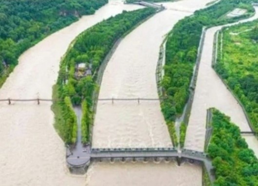
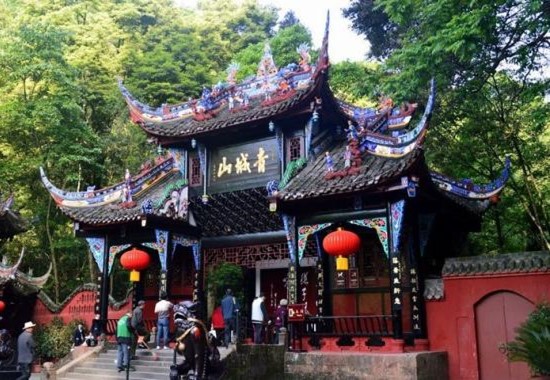
Route NO.1: Dujiangyan Project and Mount Qingcheng Price: USD 100 of each trip, tax INC, including traffic and the lunch.
Dujiangyan, the World Cultural Heritage. World Natural Heritage and World lrrigation Project Heritage, is also located in Chengdu, which has provided safe water tomillions of people for over 2,200 years and makes Chengdu known as “the land of abundance”. Mount Qingcheng is a Taoist sanctuary. Mount Qingcheng and the Dujiangyan Project are both listed as a Cultural and Natural World Heritage Site by UNESCO.
|
|
|
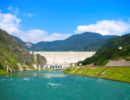
Route NO.2: Zipingpu Dam and Lijiayan Dam Price: USD 100 of each trip, tax INC, including traffic and the lunch. Zipingpu Dam, located at the upstream of Min River, is a large and irreplaceable water conservancy hub project mainly for agricultural irrigation in Dujiangyan and water delivery in Chengdu urban, as well as electricity generation, flood control, environmental protection, and other comprehensive benefits. The project has a concrete-faced rockfill dam (CFRD) with a maximum height of 156m, a reservoir with capacity of 1112 MCM, and a generation system with total installed capacity of 760MW, which was completed in 2006. On 12th May 2008 the dam withstood the severe earthquake of magnitude 8 and created a historical record in the seismic resistance of world rockfill dams.
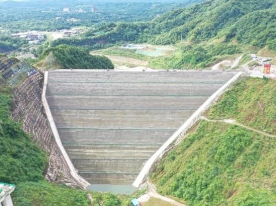
Lijiayan Dam, is located in Chengdu, Sichuan Province, with a main task of urban and rural water supply. The total reservoir capacity is 173.46 million m3 with a normal water storage level of 763m, the main structures of the project include the dam, flood discharge and energy dissipation structures, water conveyance system for power generation and water supply structures. The concrete faced rockfill dam of Lijiayan Reservoir has a maximum dam height of 123m, with crest width of 12m, and crest length of 373m. The upstream dam slope is 1:1.5, and the downstream dam slope is 1:1.6~1:1.5.In view of the complex tectonic background of the project area, combined with the relevant situation of the Wenchuan Earthquake in 2008, the seismic design of the dam is carried out with an exceedance probability of 2% in 100-year return period and a corresponding peak ground acceleration of 363cm/s2. The seismic design of the flood discharge and water supply buildings is carried out with an exceedance probability of 5% in 50-year return period and a corresponding peak ground acceleration of 206cm/s2. Seismic network monitoring systems will be installed in the dam and reservoir area.
|